The PRF is host to many activities and events, both scientific and recreational. As such there is an extensive road and trail system and we hope these maps will give you some insight into our forest.
Note trails are open to people; however, roads are gated and vehicle access is limited.
Our Trails Coordinator is Frank Knaapen frank.inthewild1@gmail.com
Disclaimer: These maps come from a variety of sources and as such we cannot guarantee their accuracy. The Friends of the Petawawa Research Forest, Inc. is not responsible for any mishap that may occur due to the use of an incorrect map obtained from this website.
You can download a printable copy of the maps below by clicking on the image:
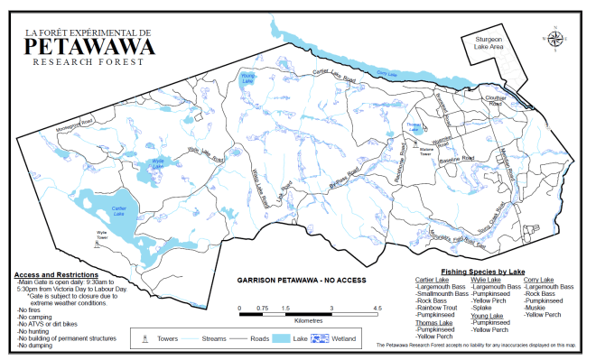
Petawawa Research Forest Map
PRF R-road map

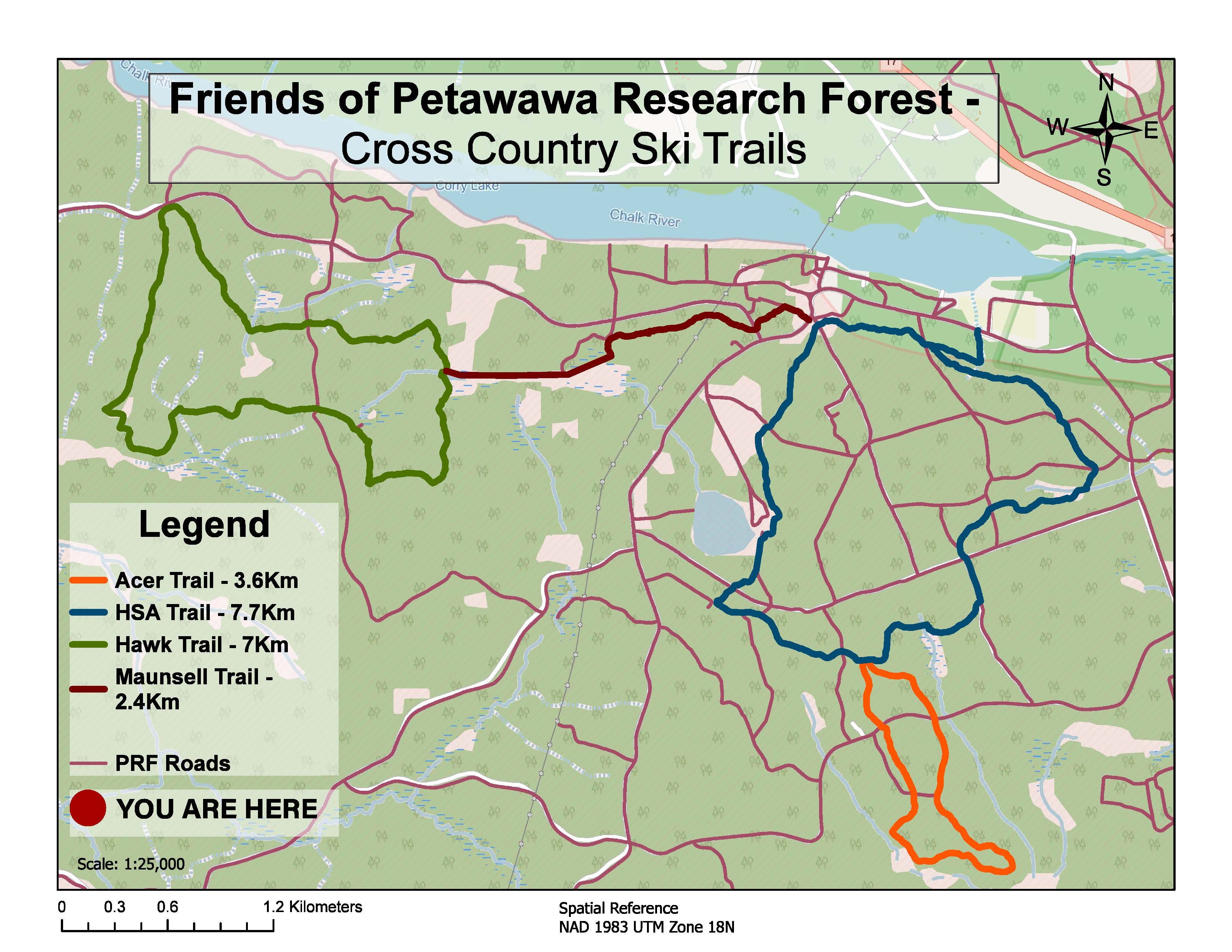
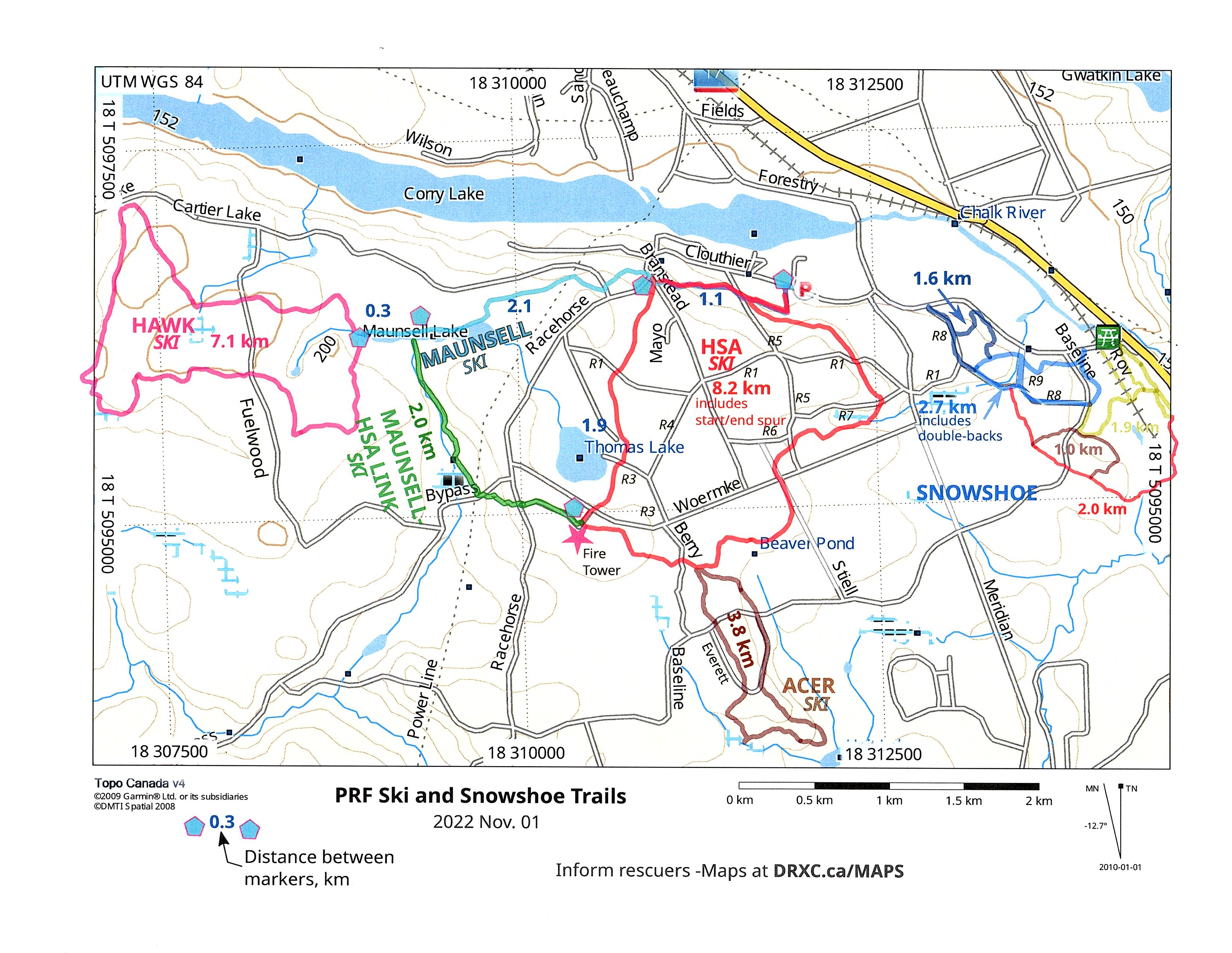
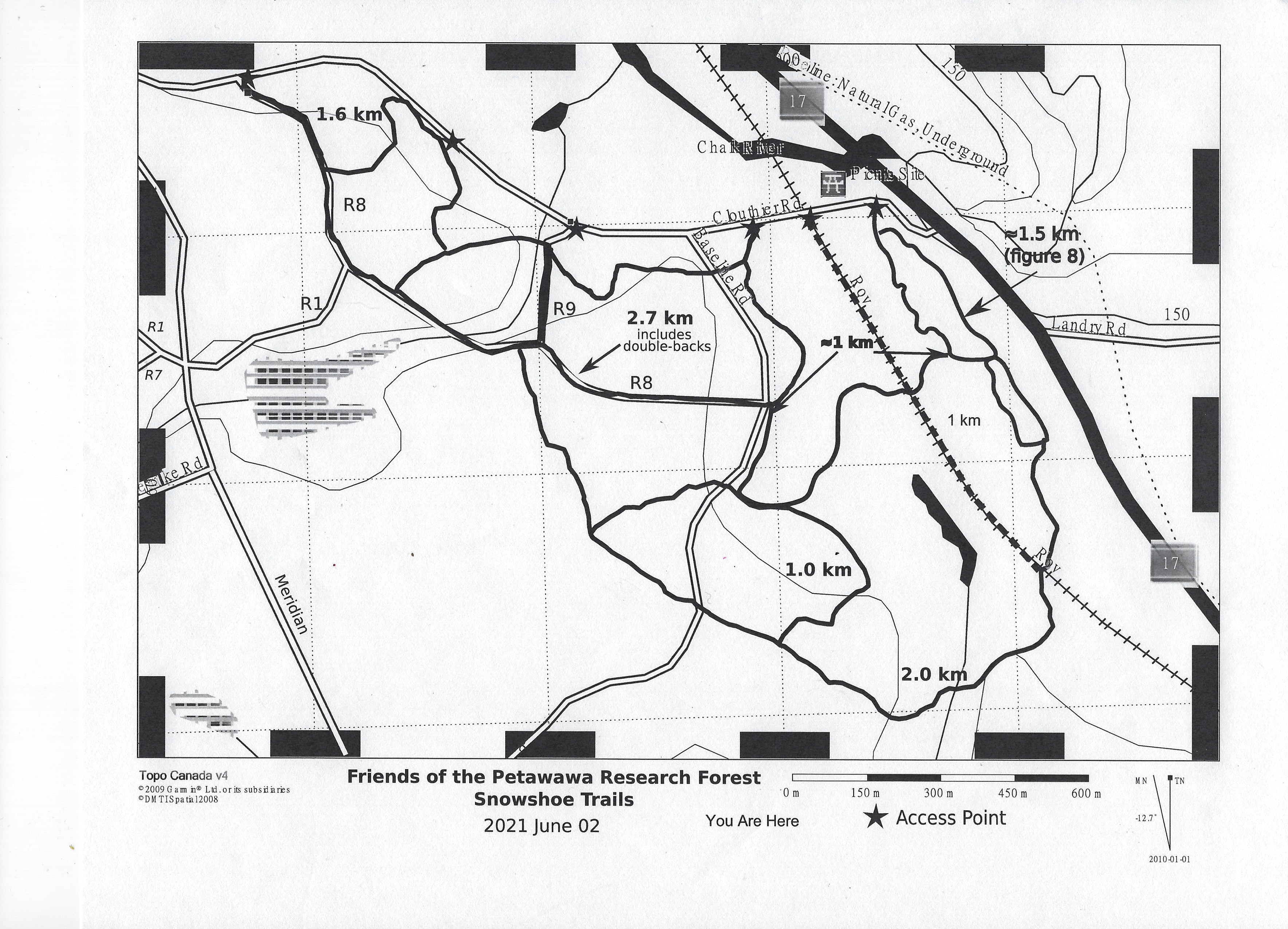
Trail Map 2025
Ski Trails September, 2023